


North Goa's Habitat Map
- pravinyacourses
- Dec 29, 2025
- 1 min read

Habitat mapping gives a clear, structured view of how landscapes are organised and how species rely on them. It helps identify vulnerable areas, track ecological change, and guide conservation with evidence rather than assumption. By revealing fragmentation, degradation, and resource pressures, it supports better policy, targeted restoration, conflict mitigation, and long-term environmental planning that avoids costly mistakes and preserves ecological stability.

Remote sensing is unmatched because it captures consistent, repeatable, and large-area information without relying on slow field surveys. It reveals patterns, changes, and hidden processes across time, even in inaccessible terrain. With multispectral and radar data, it detects vegetation health, moisture, structure, and disturbance objectively. This makes it the most reliable, scalable, and efficient approach for timely habitat assessment and long-term environmental monitoring.
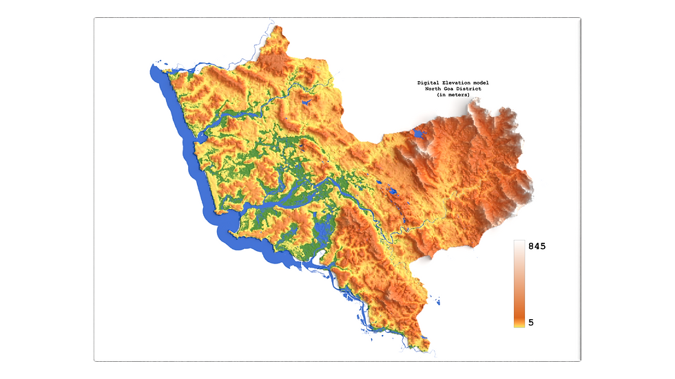
Sharing this beautiful Habitat Map generated during our recent coursework at Pravinya Research.
The map I’m sharing lacks properly oriented and overlapping boundaries, which means it cannot support any analytical or decision-making work. In its current form, it serves only for basic visual reference and should not be used for spatial analysis, metric extraction, or integration with other geospatial layers.
Visit us at https://lnkd.in/dcTcEwC9


Comments